Answers are usually just one person away you haven’t met yet.
 There are something like 1.3 million head of cattle in Wyoming. That works out to an average of about one head for every six acres of land in the state. Of course there is land that is off limits for grazing, so the density is actually greater. None of which suggests an answer for me as to where the heck all of the cows were as I drove north out of Laramie on a nearly-deserted two lane heading for Chugwater. For the first fifteen or twenty miles the road roughly parallels the winding Laramie River, off to my left traced by subtle green smears and far-off fields of big hay wheels that looked from my distance like well-spaced sheep.
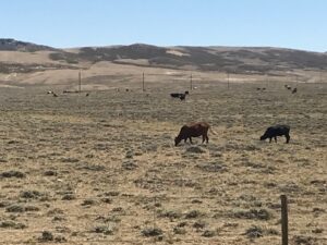
Other than that, several miles to both side of the road was a featureless expanse of flat, golden-brown, closely-cropped grass, like a bristly doormat that looks soft from a distance but is nasty to actually walk on. Fence lines bounded the road and shot off to left and right, but other than that, nothing. One lonely, short windmill posted by a small stock tank. A few old trailers and busted down out-buildings. No cattle at all that I could see, which would have been as easy as spotting raisins on a maple-frosted cake if they had been there.
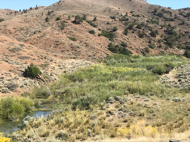
Then right at the turnoff to Chugwater the river came close by and a few dozen cattle lazed about in small, rich pastures. Another mile east, the ground gradually rising to a range of small, no-name hills, bristly grass no higher than shoelaces, spotted with ankle or calf-deep sage. Here and there, small groups of black cattle walked or lay. As I drove up through the scraggly-rocked hills, wanna-be creeks that must run after a hard rain but dive underground in this hot September, harbored enough moisture for a few head to muzzle for green shoots or just lie cool in the rare shade.
In about 25 miles driving from Laramie, I had a pretty darn good view across something like 100 square miles, or 64,000 acres. And other than that little bend of the river near the turnoff, I don’t think I saw 500 cattle, near or far from the road. They must be somewhere, but they sure weren’t grazing that brown, dry-cropped range this time of year.
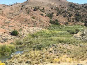 Crossing the hills, there were dashes and dots of still, greenish water in the creeks. Tangles of thick-barked, deep-rooted juniper, birch, and maybe cottonwoods hugged the narrow draw between cliffs of broken brown lichen-crusted rock, the kind, I might side-note that as a geology student, we prayed someone else had already identified and mapped, saving us the unsavory work of whacking off chunks with an eight-pound sledge to find a few fresh minerals to squint at and argue over. A few cattle hugged the narrow draw as well, and an even fewer small houses hugged pockets of the creek bottom where wells must draw from below the ephemeral stream.
When I actually sat down with a rancher the next day, all of my questions about the cattle were answered. Those wide expanses along the highway out of Laramie would be winter range; the cattle were up on BLM land for the summer; almost no one uses windmills anymore to pull up water into stock tanks when small solar-driven pumps are more reliable. I like pondering when I am driving. Answers are usually just one person away you haven’t met yet.

Funny Grant…due to my 11 years in Colorado and dating a Wyoming rancher, I knew where those cows were immediately. Glad you finally found them…or found where they were. I’ve helped push cows up to BLM range before…hot dusty work. Loving the ride Grant!